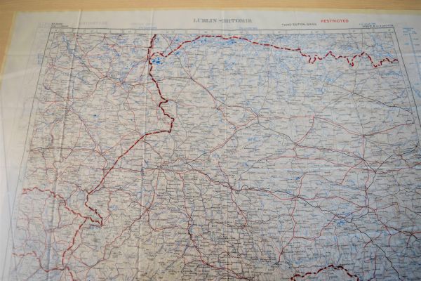
Historic fabric map of western Ukraine on display in Okanagan College Library

A silk map of western Ukraine that was carried by British or other NATO pilots during the Cold War is on display at the Library of Okanagan College’s Kelowna campus.
The map, part of the private collection of Geography Professor Terence Day, depicts regions of western Ukraine and surrounding countries. It was created for pilots to use in the event they crashed or parachuted into enemy territory and needed to escape or evade others.
Printed on silk, the map was intended to survive immersion in water, open quietly and be easily concealed in clothing. At the time it was produced, Ukraine was part of the Union of Soviet Socialists Republics (USSR).
“The map serves as a reminder of the longstanding role of NATO in the region, which is to protect the freedom and security of NATO members, including Canada, by political and military means,” says Day. “The fundamental military doctrine of NATO is that an attack on one NATO country is an attack on the entire NATO alliance.”
Ukraine is not a member nation of NATO, and the map highlights the country’s precarious position in the region. Neighbours include Russia, Belarus, Poland, Slovakia, Hungary, Romania and Moldova.
According to Day, the borders are for the most part not well defined in terms of physical geography. Historically the borders have been frequently crossed, resulting in people of Russian heritage in Ukraine and people of Ukrainian heritage in Russia.
The map, along with other resources displayed at the library, give context to some of the unfolding events in the Russian invasion of Ukraine.
Tags: Arts University Studies, Geography Earth and Environmental Sciences, Inside OC


